Satellite imagery for yield prediction: uncovering insights
Satellite imagery for yield prediction enhances farming by providing accurate insights into crop health, improving resource management, and enabling better decision-making, despite challenges like cost and data interpretation.
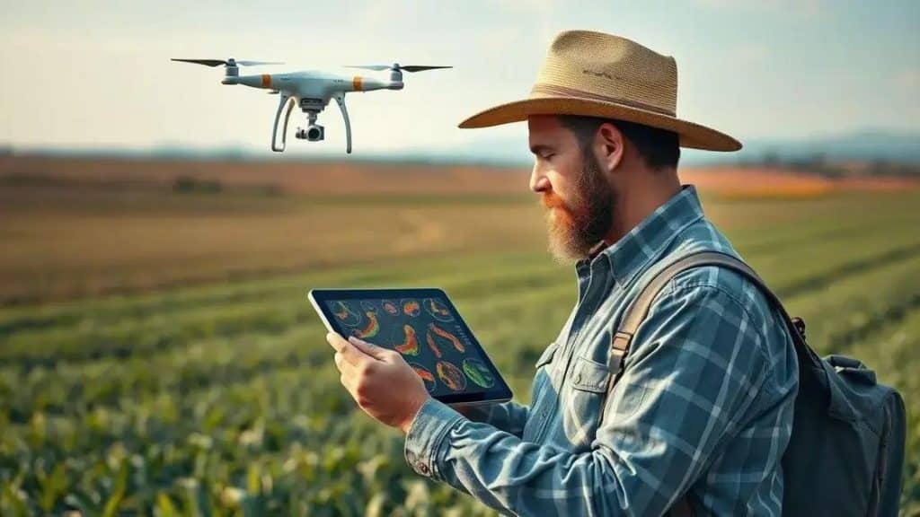
Satellite imagery for yield prediction is transforming modern agriculture. Have you ever wondered how farmers make smarter decisions about their crops? By leveraging this technology, they can optimize yields effectively.
Understanding satellite imagery technology
Understanding satellite imagery technology is essential for grasping how it can benefit agriculture. This technology utilizes advanced sensors to capture images of the Earth’s surface, helping farmers monitor their crops remotely.
Satellite imagery provides farmers with valuable insights into the health and growth of their plants. With this technology, data is collected regularly, allowing farmers to make informed decisions.
Key Features of Satellite Imagery
Several key features make satellite imagery a powerful tool for agriculture:
- High Resolution: Modern satellites capture high-resolution images, providing detailed views of crops.
- Real-Time Data: Farmers receive updates frequently, which helps them keep tabs on their fields.
- Multispectral Imaging: This technology analyzes different wavelengths of light, revealing vital information about plant health.
Understanding the nuances of this technology allows farmers to adapt their strategies effectively. For instance, by analyzing vegetation indices derived from the images, farmers can identify areas that require more attention or resources.
Additionally, satellite imagery supports precision agriculture. By integrating satellite data with other tools, such as GPS and IoT devices, farmers can enhance their operations further. This integration leads to better crop management, optimal resource allocation, and ultimately, increased yields.
Benefits of Using Satellite Imagery
Utilizing satellite imagery offers numerous advantages. It not only enhances crop production but also facilitates sustainable farming practices. By monitoring crop conditions and predicting yields, farmers can:
- Reduce Waste: Targeted actions lead to less waste of resources.
- Enhance Productivity: Accurate data helps improve overall agricultural outcomes.
- Monitor Climate Effects: Farmers can see how weather changes impact their crops.
In conclusion, the adoption of satellite imagery technology is a game changer in the agricultural sector. It empowers farmers with information that can lead to better decision-making and greater efficiency in their practices.
How yield prediction improves agricultural planning

How yield prediction improves agricultural planning is a vital aspect of modern farming. By accurately forecasting crop yields, farmers can make better decisions on resource allocation and management.
Yield prediction relies on various data sources, including weather forecasts, soil health, and crop monitoring. These data help create more accurate models that farmers can trust.
Importance of Accurate Yield Prediction
Accurate yield predictions are crucial for several reasons:
- Resource Management: Knowing expected yields allows farmers to allocate resources effectively, reducing waste and costs.
- Financial Planning: Farmers can plan their finances based on predicted harvests, ensuring they have enough funds for the season.
- Market Strategy: With yield predictions, farmers can better assess market conditions and decide when to sell their produce.
By using advanced analytics and satellite imagery, farmers can refine their yield predictions. This approach not only increases efficiency but also enhances sustainability by minimizing overproduction and its associated costs.
Moreover, farmers can optimize planting schedules based on yield predictions. They can select the best planting times and crop varieties that suit their local conditions, improving their overall outcomes significantly.
Technological Tools Enhancing Yield Prediction
Several tools and technologies are enhancing the accuracy of yield prediction. These include:
- Remote Sensing: This technology allows farmers to gather data from a distance, using satellites to assess crop conditions.
- Data Analytics: Analyzing historical data helps in understanding trends and making informed predictions.
- Machine Learning: AI models can improve the accuracy of predictions by learning from vast datasets.
Applying these tools leads to smarter agricultural practices. Farmers can stay ahead of challenges, ensuring they remain competitive while promoting sustainability in their operations.
Case studies on successful yield prediction
Case studies on successful yield prediction showcase how technology is transforming farming practices. These real-world examples highlight the effective use of yield prediction methods to enhance agricultural outcomes.
Many farms have adopted satellite imagery and data analytics to improve their productivity. For instance, a farm in California utilized satellite data to forecast their grape harvest, allowing them to optimize their irrigation schedule.
Successful Agricultural Examples
Several case studies illustrate the advantages of yield prediction:
- Wheat Farms in Australia: By using yield forecasting models, farmers reduced costs and increased wheat output by 15%.
- Corn Production in Iowa: Implementing precision agriculture techniques helped farmers anticipate yield changes based on weather patterns, resulting in higher profits.
- Rice Farming in India: Utilizing satellite imagery for crop health assessment allowed farmers to identify issues early, improving yields by up to 20%.
These case studies demonstrate the potential of yield prediction in making data-driven decisions. Farmers can refine their practices based on reliable forecasts, ultimately leading to more sustainable agriculture.
Furthermore, the integration of machine learning has revolutionized yield prediction. By analyzing historical yield data alongside current conditions, farmers can gain insights that were previously unavailable. This technology not only aids in planning but also sets the groundwork for innovative practices in the future.
The Future of Yield Prediction
As yield prediction technology continues to evolve, it is expected to play an even larger role in modern agriculture. Farmers will increasingly depend on these tools to improve efficiency and adapt to changing agricultural environments. The ongoing success stories in various parts of the world illustrate the importance of embracing these advancements.
Challenges in using satellite imagery for agriculture

Challenges in using satellite imagery for agriculture are important to understand as farmers adopt new technologies. While satellite imagery provides valuable insights, there are obstacles that can hinder its effectiveness.
One major challenge is the cost of obtaining high-quality satellite data. Farmers may find that purchasing images or accessing necessary software can be expensive. This raised cost can limit the number of farmers who can utilize this technology effectively.
Data Interpretation Issues
Another challenge is related to interpreting the data generated from satellite imagery.
- Complex Analysis: Analyzing satellite data often requires expertise in data science or agronomy.
- Training Needs: Farmers may need training to understand how to use this data effectively, which adds another layer of complexity.
- Variable Accuracy: The accuracy of satellite data can vary depending on weather conditions and the specific technology used.
Farmers may struggle to draw actionable insights from the data without proper training. Reportedly, many farmers feel overwhelmed by the amount of information available and may not know how to apply it to their unique situations.
Additionally, connectivity issues can arise in rural areas. A strong internet connection is often required to analyze and download data from satellites. In regions with poor internet service, farmers may face barriers to accessing real-time information.
Environmental Factors
There are also environmental challenges to consider. Satellite imagery may not capture micro-level variations in fields due to its broad coverage. This means that issues like specific pest infestations or localized nutrient deficiencies might go unnoticed.
Moreover, relying solely on satellite imagery might lead to a lack of ground-truthing, which is when farmers check conditions in their fields directly. Balancing satellite data with in-field observations is essential for effective farm management.
FAQ – Frequently Asked Questions about Satellite Imagery for Yield Prediction
How can satellite imagery improve agricultural planning?
Satellite imagery provides farmers with accurate yield predictions, helping them manage resources effectively and make informed decisions.
What are the main challenges of using satellite imagery in agriculture?
Challenges include high costs, data interpretation complexity, environmental factors, and the need for reliable internet connectivity.
Can satellite imagery replace traditional farming practices?
No, satellite imagery should complement traditional methods. Combining both can lead to better overall agricultural outcomes.
What technologies enhance yield prediction based on satellite imagery?
Technologies such as remote sensing, data analytics, and machine learning work alongside satellite imagery to improve yield predictions.


