Remote Sensing for Agriculture: Monitoring Crop Health and Predicting Yields
Remote sensing technologies, utilizing satellite imagery, offer advanced methods for monitoring crop health, predicting yields, and optimizing agricultural practices, enhancing efficiency and sustainability in farming.
Remote sensing technologies: monitoring crop health and predicting yields with satellite imagery are transforming agriculture by providing farmers with crucial data to optimize their practices. This technology allows for efficient crop management, early detection of stressors, and more accurate yield predictions.
The Basics of Remote Sensing in Agriculture
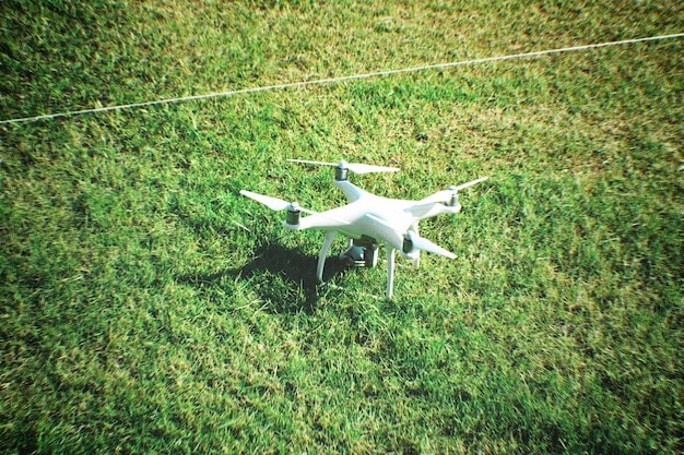
Remote sensing uses satellite and aerial imagery to gather information about the Earth’s surface without physical contact. In agriculture, this technology allows for monitoring vast fields, identifying plant health issues, and predicting yields more accurately.
This overview explains how remote sensing is applied, the types of sensors used, and the benefits of integrating this technology into farming practices.
What is Remote Sensing?
Remote sensing involves detecting and measuring electromagnetic radiation reflected or emitted from objects or areas. In agriculture, this means capturing data about crops using sensors mounted on satellites, aircraft, or drones.
The data collected can then be analyzed to assess various aspects of crop health, identify stress factors, and estimate yields.
Types of Sensors Used
Different sensors capture different types of data. Some common types include:
- Multispectral Sensors: Capture data in multiple narrow bands of the electromagnetic spectrum, providing information on plant health and vegetation indices.
- Hyperspectral Sensors: Capture data in hundreds of narrow bands, offering more detailed information about plant characteristics and stress detection.
- Thermal Sensors: Measure the temperature of plants, which can indicate water stress or disease.
- LiDAR: Uses laser light to create detailed 3D models of the landscape, which can be used to measure plant height and biomass.
Benefits of Integration
Integrating remote sensing into farming practices offers several benefits:
- Improved Crop Monitoring: Allows farmers to monitor the health of their crops over large areas quickly and efficiently.
- Early Stress Detection: Helps identify plant stress early, enabling timely intervention.
- Optimized Resource Use: Facilitates efficient allocation of water, fertilizers, and pesticides based on specific needs.
- Enhanced Yield Prediction: Provides accurate yield estimates, aiding in decision-making for harvesting and marketing.
In conclusion, the adoption of remote sensing technologies in agriculture is a game-changer. It allows farmers to gather and analyze crop information with precision and efficiency, optimizing resources, and improving yield prediction.
Monitoring Crop Health with Remote Sensing
Remote sensing technologies play a crucial role in monitoring crop health by detecting variations in vegetation indices and identifying areas affected by stress. These technologies offer insights that are difficult or impossible to obtain through manual inspection.
This section delves into the specific vegetation indices used, how remote sensing detects stress, and the advantages of early detection methods.
Vegetation Indices
Vegetation indices are mathematical combinations of different spectral bands that provide quantitative measures of vegetation characteristics. Some commonly used indices include:
- Normalized Difference Vegetation Index (NDVI): Measures the greenness of vegetation based on the difference between near-infrared and red light reflectance.
- Enhanced Vegetation Index (EVI): Similar to NDVI but less sensitive to atmospheric effects and soil background.
- Leaf Area Index (LAI): Estimates the area of leaves per unit of ground area, indicating vegetation density.
These indices help farmers assess the overall health and vigor of their crops.
Detecting Stress with Remote Sensing
Remote sensing can detect various types of plant stress, including water stress, nutrient deficiencies, and disease outbreaks. Plants under stress often exhibit changes in their spectral reflectance that can be detected by sensors.
For example, water-stressed plants may have lower NDVI values, while plants with nutrient deficiencies may show altered spectral signatures in specific bands.
Advantages of Early Detection
Early detection of plant stress enables farmers to take timely action to mitigate the problem. This can involve adjusting irrigation schedules, applying fertilizers, or implementing pest control measures.
Early detection methods can prevent widespread damage, minimize yield losses, and optimize resource use.
In summary, remote sensing offers powerful tools for monitoring crop health through the use of vegetation indices and early stress detection, enabling timely intervention and improved agricultural outcomes.
Predicting Crop Yields with Satellite Imagery
Predicting crop yields is essential for farmers to make informed decisions about harvesting, storage, and marketing. Satellite imagery and remote sensing provide valuable data for yield prediction models.
This section explores the methods and models used for yield prediction, the data inputs required, and the benefits of accurate yield forecasting.
Methods and Models for Yield Prediction
Several methods and models can be used to predict crop yields based on remote sensing data:
- Regression Models: Relate yield data to vegetation indices and other environmental factors using statistical regression techniques.
- Crop Simulation Models: Integrate remote sensing data with biophysical models that simulate plant growth and development.
- Machine Learning Models: Use algorithms to learn patterns from historical data and predict yields based on current conditions.
These models can provide accurate yield predictions at various scales, from individual fields to entire regions.
Data Inputs for Yield Prediction
Accurate yield prediction requires a combination of remote sensing data, environmental information, and historical yield records. Key data inputs include:
- Vegetation Indices: NDVI, EVI, and LAI provide information on plant biomass and health.
- Weather Data: Temperature, precipitation, and solar radiation influence plant growth and yield.
- Soil Properties: Soil type, texture, and nutrient content affect plant productivity.
By integrating these data inputs, yield prediction models can provide more reliable estimates.
Benefits of Accurate Yield Forecasting
Accurate yield forecasting offers numerous benefits to farmers, agribusinesses, and policymakers. These benefits include:
- Improved Decision-Making: Farmers can make informed decisions about when to harvest, how much to store, and when to sell their crops.
- Optimized Supply Chain Management: Agribusinesses can better plan their supply chains to meet demand and minimize waste.
- Enhanced Food Security: Policymakers can use yield forecasts to assess food security risks and develop appropriate interventions.
In conclusion, predicting crop yields with satellite imagery enhances decision-making at multiple levels and enhances preparedness and efficiency in agricultural practices.
Challenges and Limitations
While remote sensing technologies offer numerous benefits for monitoring crop health and predicting yields, there are also several challenges and limitations that need to be addressed.
This section discusses issues related to data accuracy, technological constraints, and the costs associated with implementing remote sensing technologies.
Data Accuracy and Calibration
The accuracy of remote sensing data can be affected by several factors, including atmospheric conditions, sensor calibration, and data processing techniques. It is essential to calibrate sensors and process data carefully to minimize errors.
Ground truthing, which involves collecting data in the field to validate remote sensing data, is also crucial for ensuring accuracy.
Technological Constraints
There are several technological constraints associated with remote sensing technologies. These include:
- Spatial Resolution: The size of the smallest object that can be distinguished in an image. Lower resolution images may not be suitable for monitoring small fields or individual plants.
- Temporal Resolution: The frequency with which images are acquired. Infrequent image acquisition may miss important events, such as disease outbreaks or water stress episodes.
- Spectral Resolution: The number and width of the spectral bands captured by a sensor. Insufficient spectral resolution may limit the ability to distinguish between different types of plant stress.
Addressing these technological constraints requires ongoing research and development.
Costs and Implementation Barriers
The costs associated with implementing remote sensing technologies can be a barrier for some farmers, particularly those with small-scale operations. These costs include:
- Data Acquisition: Purchasing satellite or aerial imagery can be expensive.
- Data Processing: Processing remote sensing data requires specialized software and expertise.
- Equipment and Infrastructure: Investing in drones, sensors, and other equipment can be costly.
Providing affordable access to remote sensing technologies and training is essential for promoting widespread adoption.
In summary, overcoming the challenges and limitations related to data accuracy, technological constraints, and costs will be crucial for maximizing the benefits of remote sensing in agriculture.
Future Trends in Remote Sensing for Agriculture
The future of remote sensing in agriculture is bright, with several emerging trends that promise to further enhance its capabilities and applications. These trends include advancements in sensor technology, the integration of artificial intelligence, and the expansion of data accessibility.
This section explores these future trends in detail.
Advancements in Sensor Technology
Sensor technology is constantly evolving, with new sensors being developed that offer improved spatial, temporal, and spectral resolution. Some notable advancements include:
- Improved Hyperspectral Sensors: Offering more detailed information about plant characteristics and stress detection.
- Miniaturized Sensors: Enabling the deployment of sensors on smaller and more affordable drones.
- Integration of Multiple Sensors: Combining data from different sensors to provide a more comprehensive view of crop health and yield potential.
These advancements will enable more precise and efficient monitoring of crops.
Integration of Artificial Intelligence
Artificial intelligence (AI) is playing an increasingly important role in remote sensing for agriculture. AI algorithms can be used to:
- Automate Data Processing: Reducing the time and effort required to analyze remote sensing data.
- Improve Yield Prediction: Developing more accurate and robust yield prediction models.
- Detect Anomalies: Identifying unusual patterns or conditions that may indicate plant stress or disease outbreaks.
The integration of AI will enable farmers to make more informed decisions and optimize their farming practices.
Increased Data Accessibility
Data accessibility is improving, with more satellite and aerial imagery being made available to the public at little or no cost. This is due to factors such as:
- Open Data Policies: Governments and organizations are increasingly adopting open data policies that promote the sharing of remote sensing data.
- Cloud Computing: Cloud-based platforms are making it easier to access, process, and analyze large volumes of remote sensing data.
- Community-Based Sensing: Citizen science initiatives are contributing to the collection and sharing of remote sensing data.
Increased data accessibility will empower more farmers and agribusinesses to benefit from remote sensing technologies.
The future of remote sensing is promising, with advancements and integration of AI allowing for more precise and efficient monitoring of plants and cultivation.
Case Studies: Successful Implementations
Several case studies highlight the successful implementation of remote sensing technologies in agriculture, demonstrating their potential to improve crop management, enhance yield prediction, and optimize resource use.
This section presents a few examples of these successful implementations.
Precision Irrigation in California
In California, remote sensing technologies have been used to optimize irrigation practices in vineyards and orchards. By monitoring plant water stress using thermal sensors and vegetation indices, farmers have been able to:
- Reduce Water Consumption: Applying water only where and when it is needed, minimizing water waste.
- Improve Crop Quality: Ensuring that plants receive the optimal amount of water, resulting in higher-quality fruit.
- Increase Yields: Promoting healthy plant growth and maximizing yields.
This implementation has resulted in significant cost savings and environmental benefits.
Disease Detection in the Midwest
In the Midwestern United States, remote sensing technologies have been used to detect and monitor disease outbreaks in corn and soybean fields. By analyzing spectral signatures of plants, farmers have been able to:
- Identify Diseased Areas Early: Enabling timely intervention to prevent the spread of disease.
- Targeted Treatment: Applying treatments only to affected areas, minimizing the use of pesticides.
- Reduce Yield Losses: Preventing widespread damage and reducing yield losses.
This implementation has helped farmers protect their crops and reduce their environmental impact.
Yield Prediction in Brazil
In Brazil, remote sensing technologies have been used to predict crop yields in large-scale soybean and sugarcane farms. By integrating satellite imagery with weather data and crop models, farmers have been able to:
- Accurately Forecast Yields: Making informed decisions about harvesting, storage, and marketing.
- Optimize Supply Chain Management: Planning their supply chains more efficiently.
- Enhance Food Security: Providing reliable yield estimates to policymakers.
These case studies demonstrate the successful implementation of remote sensing technologies in various agricultural settings, highlighting their potential to transform farming practices.
In conclusion, the case studies demonstrate the real-world benefits of remote sensing in various agricultural practices, and it highlights the potential for broader adoption and innovation around the globe.
| Key Point | Brief Description |
|---|---|
| 🛰️ Remote Sensing Basics | Utilizes satellite/aerial imagery for non-contact data collection on crop health and yields. |
| 🌱 Crop Health Monitoring | Employs vegetation indices like NDVI to assess plant stress and health efficiently. |
| 🚜 Yield Prediction | Uses regression, simulation, & ML models with data inputs for accurate forecasting. |
| 📊 Future Trends | Advancements in sensors, AI integration, & accessible data will reshape agriculture. |
Frequently Asked Questions
▼
NDVI stands for Normalized Difference Vegetation Index, it measures the greenness of vegetation by comparing the reflectance of near-infrared and red light, indicating plant health.
▼
Remote sensing detects plant stress by analyzing changes in plants’ spectral reflectance. Stressed plants often show alterations in their reflectance patterns that sensors can identify.
▼
Accurate yield forecasting allows farmers to make informed harvesting and marketing decisions, helps agribusinesses plan supply chains, and aids policymakers in addressing food security risks.
▼
Limitations include data accuracy issues due to atmospheric conditions, technical constraints related to resolution, and high costs for data acquisition, processing, and equipment.
▼
AI automates data processing, enhances the precision of yield prediction models, and helps detect anomalies that may signal plant stress or the proliferation of disease within crops.
Conclusion
In conclusion, remote sensing technologies: monitoring crop health and predicting yields with satellite imagery are revolutionizing agriculture. By integrating advancements in sensor technology, artificial intelligence, and increased data accessibility, farmers can optimize resource use, improve crop management, and enhance food security.


