Precision agriculture drone mapping: enhancing crop yield
Precision agriculture drone mapping enhances farming by providing real-time data, improving crop management, optimizing resource use, and promoting sustainable practices through advanced technology.
Precision agriculture drone mapping is quickly changing the way farmers approach crop management. Imagine having the ability to monitor your fields from above, gaining insights that can significantly boost your yield. Have you ever wondered how this technology truly impacts farming?
What is precision agriculture drone mapping?
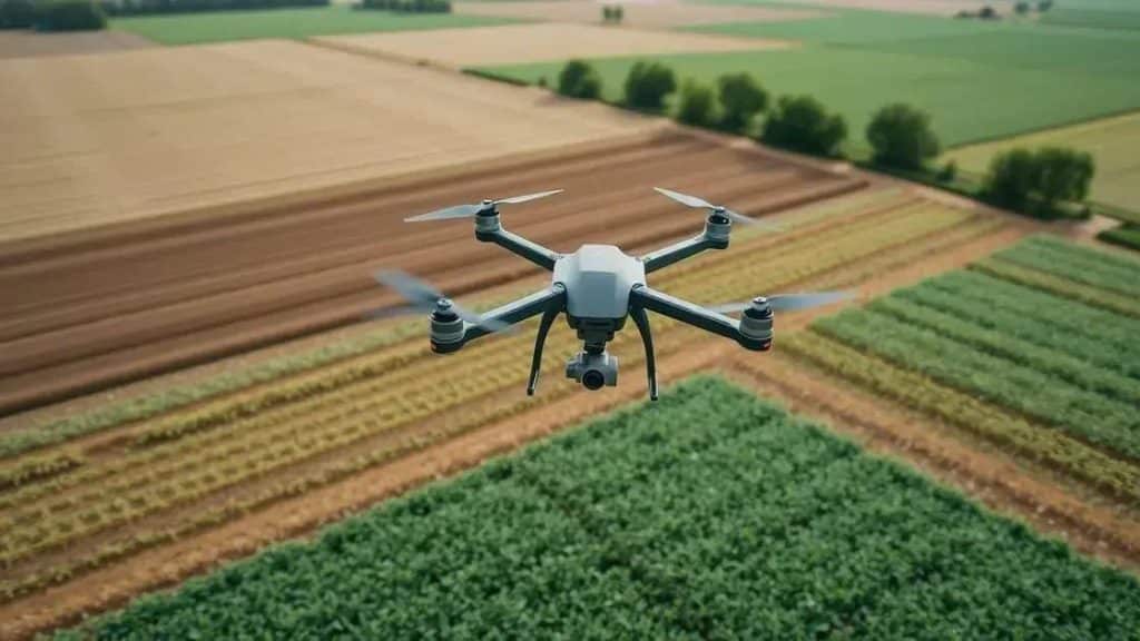
Precision agriculture drone mapping utilizes advanced drone technology to collect high-resolution data about crops and fields. This innovative method allows farmers to see their fields from a new perspective, enhancing their decision-making processes.
Drones equipped with cameras and sensors fly over farms, capturing images that reveal essential information about crop health and soil conditions. By analyzing these images, farmers can make informed decisions that lead to better crop management.
Key Features of Drone Mapping
This technology offers several notable features that make it invaluable for modern farming:
- Aerial Imaging: Drones provide detailed aerial views of fields, highlighting areas that require attention.
- Real-Time Data: Farmers receive immediate insights, allowing for quick responses to emerging problems.
- High Precision: The maps produced are accurate, providing specific information needed for targeted interventions.
- Cost-Effective: Utilizing drones reduces the need for manual labor and streamlines the data collection process.
Through the use of precision agriculture drone mapping, farmers can monitor their crops more effectively. This real-time data helps them identify issues such as pest infestations or nutrient deficiencies early on, allowing for timely interventions that can significantly improve yield.
The ability to generate detailed maps allows for better planning and resource allocation. For instance, farmers can determine which areas of their fields need more water or fertilizer based on the insights gathered from drone data. This not only maximizes productivity but also contributes to sustainable farming practices by minimizing the use of resources.
Key benefits of drone mapping in agriculture

Drone mapping in agriculture brings a wealth of benefits to modern farming. Farmers today face various challenges, and using drone technology can offer solutions that were previously unimaginable.
First and foremost, one of the key advantages is the ability to monitor crops in real-time. This means that farmers can identify problems early, such as disease or pests, before they cause significant damage.
Cost Efficiency
Implementing drone mapping can significantly reduce costs associated with traditional methods. Instead of manually inspecting fields, which can be time-consuming and labor-intensive, drones provide a faster and more efficient alternative. This technology allows farmers to cover large areas in a short amount of time.
- Reducing Labor Costs: Fewer workers are needed for field inspections.
- Minimizing Resource Use: Targeted actions prevent wasted inputs like water and fertilizers.
- Lowering Error Rates: Drones provide precise data that helps avoid costly mistakes.
Furthermore, drone mapping enhances data collection. By utilizing this technology, farmers can gather accurate data on crop health and soil conditions. This information is crucial for making informed decisions about planting, irrigation, and fertilization.
Data analytics from drones can highlight specific areas that need attention, enabling targeted interventions. For instance, if a section of the field is underperforming, farmers can quickly adjust their strategies, whether that means applying more nutrients or adjusting irrigation patterns. Overall, this precise approach maximizes yield while promoting sustainability.
How drone mapping improves crop management
Drone mapping has revolutionized crop management by providing farmers with the tools they need to optimize their operations. This technology allows for detailed monitoring of crop conditions, which is vital for making informed decisions throughout the growing season.
One of the primary ways that drone mapping improves management is through precise data collection. Drones gather high-resolution images and data, giving farmers insights into the health of their crops. This capability enables quick identification of issues such as pests, diseases, and nutrient deficiencies.
Enhanced Monitoring
Regular monitoring using drones can significantly reduce the risk of large-scale crop loss. By utilizing drone technology, farmers can:
- Identify issues early: Swift detection and response to problems prevent more extensive damage.
- Analyze crop health: Monitoring patterns can show which areas need more attention.
- Optimize resources: Farmers can allocate water and fertilizers more effectively based on real-time data.
This targeted approach leads to better planning and reduces waste, which is essential for both profitability and sustainability. Additionally, drone data can be integrated into farm management systems, allowing farmers to make data-driven decisions more efficiently.
The use of drone mapping also facilitates better communication with agricultural experts. By sharing drone data with agronomists, farmers can receive tailored advice on how to improve their crop management strategies. This collaborative effort can lead to enhanced yields and healthier crops.
Future trends in drone technology for farming

The future of drone technology in farming holds great promise, with advancements expected to revolutionize agricultural practices further. As technology evolves, farmers will gain access to even more sophisticated tools that enhance efficiency and productivity.
One major trend is the integration of artificial intelligence (AI) and machine learning into drone systems. This will enable drones to analyze data in real-time, providing farmers with critical insights about their crops and fields. With AI capabilities, drones can predict potential issues before they arise, allowing for proactive management.
Increased Automation
As drones become more advanced, automation will likely increase. Farmers will benefit from:
- Automatic data collection: Drones can operate on predetermined flight paths, consistently gathering data without manual intervention.
- Enhanced task performance: From planting seeds to applying pesticides, drones will be able to perform various agricultural tasks autonomously.
- Improved scheduling: Data gathered can help optimize farming schedules, leading to better resource allocation.
Additionally, the use of fleet management systems will become more common. Farmers can operate multiple drones simultaneously, streamlining operations and maximizing coverage of their fields. This systems approach can help manage crop health more efficiently across larger areas.
As sustainability becomes increasingly important, drones will also play a crucial role in promoting eco-friendly farming. Precision applications of fertilizers and pesticides will minimize waste and reduce environmental impact. This targeted approach supports the goal of achieving higher yield while using fewer resources, aligning with the global push for sustainable agriculture.
FAQ – Frequently Asked Questions about Drone Technology in Agriculture
How does drone technology benefit crop management?
Drone technology enhances crop management by providing real-time data, allowing for timely interventions and optimized resource use.
What are the key features of drone mapping in agriculture?
Key features include aerial imaging, real-time data collection, high precision, and cost-effectiveness, all contributing to better farming decisions.
How can drones help with sustainability in farming?
Drones promote sustainability by enabling precise applications of water and fertilizers, reducing waste, and minimizing environmental impact.
What future advancements can we expect from drone technology?
Future advancements include greater automation, AI integration for predictive analytics, and improved fleet management systems for efficient farming.


