Drone Tech for Crop Monitoring: 2026 Innovations & 20% Yield Boost
By 2026, advanced drone technology for crop monitoring is set to revolutionize agriculture, leveraging AI, hyper-spectral imaging, and autonomous systems to deliver up to a 20% improvement in crop yields through precise, data-driven insights.
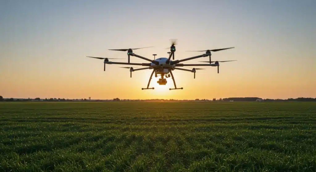
The agricultural landscape is undergoing a profound transformation, with technology at its core. Among the most impactful advancements, drone crop monitoring 2026 innovations are leading the charge, promising unprecedented precision and efficiency. These aerial sentinels, once a novelty, are now indispensable tools for farmers seeking to optimize every aspect of crop management. The integration of cutting-edge sensors, artificial intelligence, and sophisticated data analytics is not just incremental; it represents a paradigm shift, poised to deliver a remarkable 20% improvement in crop yields. This evolution is vital for meeting global food demands while ensuring sustainable practices.
The Evolution of Drone Technology in Agriculture
Drone technology in agriculture has come a long way from simple aerial photography. What began as a means to capture basic visual information has rapidly evolved into a complex ecosystem of hardware and software designed for intricate data collection and analysis. The journey from rudimentary UAVs to highly autonomous, AI-powered systems demonstrates a relentless pursuit of efficiency and accuracy in farming.
Early agricultural drones were primarily used for surveying and mapping fields, providing farmers with a bird’s-eye view of their land. While valuable, these initial applications only scratched the surface of their potential. Today, the focus has shifted towards active crop monitoring, identifying issues before they become critical, and enabling proactive intervention. This proactive approach is a cornerstone of modern precision agriculture.
From Basic Imaging to Advanced Multispectral Analysis
The leap from standard RGB cameras to advanced multispectral and hyperspectral sensors has been pivotal. These specialized cameras can detect differences in light reflectance that are invisible to the human eye, revealing subtle indicators of plant stress, nutrient deficiencies, and disease outbreaks. This detailed information allows for highly targeted interventions, minimizing waste and maximizing resource utilization.
- Multispectral Sensors: Capture data across specific light bands (e.g., red, green, blue, near-infrared), revealing plant health indices like NDVI.
- Hyperspectral Imaging: Collects data from hundreds of narrow spectral bands, offering a much richer, more detailed spectral signature for precise plant diagnostics.
- Thermal Imaging: Detects temperature variations, indicating water stress or disease presence before visible symptoms appear.
This technological progression provides farmers with an unparalleled understanding of their crops’ health, enabling them to make informed decisions that directly impact yield and profitability. The ability to peer into the invisible spectrum of plant health is a game-changer for agricultural management.
The evolution underscores a broader trend in agricultural technology: the move towards increasingly sophisticated data acquisition and interpretation. As drones become more capable of gathering diverse data types, the challenge and opportunity lie in translating this raw information into actionable insights that can genuinely drive productivity improvements. This continuous development ensures that drone technology remains at the forefront of agricultural innovation.
AI and Machine Learning: Powering Predictive Analytics
The true potential of drone-collected data is unlocked through the application of artificial intelligence (AI) and machine learning (ML). Raw sensor data, no matter how detailed, is just information until it is processed and interpreted by intelligent algorithms. By 2026, AI and ML are not merely assisting farmers; they are becoming indispensable partners in decision-making, transforming reactive farming into predictive agriculture.
These advanced analytical tools can process vast datasets from drone flights, identifying patterns and anomalies that would be impossible for humans to discern. From predicting disease outbreaks based on subtle spectral shifts to optimizing irrigation schedules by analyzing soil moisture patterns, AI provides a layer of intelligence that significantly enhances farming operations.
Real-time Data Processing and Actionable Insights
One of the most significant advancements is the ability to perform real-time data processing. Drones equipped with edge computing capabilities can analyze data onboard, providing immediate insights to farmers in the field. This reduces the delay between data collection and decision-making, allowing for prompt corrective actions.
- Automated Disease Detection: AI models trained on vast image datasets can instantly identify early signs of plant diseases, often before they are visible to the naked eye.
- Nutrient Deficiency Mapping: Machine learning algorithms analyze multispectral data to create precise nutrient maps, guiding variable-rate fertilizer applications.
- Yield Prediction Models: AI-driven models can forecast crop yields with greater accuracy by integrating drone data with historical weather patterns and soil conditions.
The integration of AI and ML means that drones are no longer just data collectors; they are intelligent systems that provide actionable intelligence. This shift is crucial for achieving the projected 20% yield improvement, as it allows farmers to intervene with surgical precision, saving resources and maximizing output.
The continuous learning capabilities of these AI systems mean they become more accurate and efficient over time, adapting to new environmental conditions and crop varieties. This adaptive intelligence makes them invaluable assets for farmers navigating the complexities of modern agriculture. The synergy between drone hardware and AI software is the engine driving the next wave of agricultural productivity.
Autonomous Drone Systems and Swarm Technology
The future of drone crop monitoring in 2026 is increasingly autonomous. Farmers will spend less time manually piloting drones and more time interpreting the data they gather. Autonomous drone systems, guided by sophisticated navigation and mission planning software, can cover vast areas with minimal human intervention, ensuring consistent data collection and reducing operational costs.
Beyond single autonomous drones, swarm technology is emerging as a groundbreaking innovation. Imagine a fleet of drones working collaboratively, each performing a specific task or covering a designated section of a field. This coordinated effort dramatically increases coverage efficiency and data collection speed, making large-scale precision agriculture more feasible than ever.
Enhanced Efficiency with Coordinated Fleets
Swarm technology allows for parallel data collection, significantly reducing the time required to survey extensive fields. Each drone in the swarm can be equipped with different sensors, allowing for comprehensive data capture in a single mission. This multi-sensor, multi-drone approach provides a richer and more varied dataset for analysis.
- Synchronized Mapping: Multiple drones can map a large area simultaneously, stitching together individual maps into a single, high-resolution overview.
- Targeted Intervention Swarms: Drones can work together to identify problem areas and then deploy targeted treatments, such as precision spraying of pesticides or fertilizers.
- Real-time Obstacle Avoidance: Advanced AI allows drone swarms to navigate complex environments, avoiding obstacles and coordinating flight paths dynamically.
The development of increasingly sophisticated autonomous capabilities and swarm intelligence is critical for scaling drone-based precision agriculture. These systems not only reduce labor requirements but also ensure a higher degree of accuracy and consistency in data collection, which is paramount for effective crop management.
The integration of these autonomous and swarm capabilities represents a significant leap forward, moving beyond individual drone operations to a networked, intelligent aerial system. This level of automation and coordination will be instrumental in achieving the ambitious goals of increased yield and reduced environmental impact in agriculture.
Hyper-spectral and Lidar Sensors: Unlocking Deeper Insights
While multispectral sensors have been a staple in agricultural drones, the advent of hyper-spectral and Lidar sensors is pushing the boundaries of what’s detectable from above. These advanced sensor technologies provide an unprecedented level of detail, allowing farmers to gain deeper insights into plant physiology and field topography, which were previously unattainable without ground-based measurements.
Hyper-spectral imaging, as mentioned, captures a continuous spectrum of light, providing a unique spectral fingerprint for each plant and soil type. Lidar (Light Detection and Ranging), on the other hand, uses pulsed laser light to measure distances, generating highly accurate 3D models of the terrain and crop canopy structure. Both technologies contribute significantly to a more holistic understanding of the agricultural environment.
The combination of these sensors offers a powerful toolkit for precision agriculture, enabling farmers to identify subtle changes in crop health, assess biomass, and even predict water requirements with remarkable accuracy. This detailed information is crucial for optimizing resource allocation and maximizing crop potential.
Precision Mapping and Environmental Monitoring
Lidar technology, in particular, is revolutionizing terrain mapping and canopy analysis. Its ability to penetrate dense foliage allows for accurate measurements of plant height, density, and even individual plant counts, providing valuable data for yield estimation and growth monitoring. Hyper-spectral data complements this by offering insights into the biochemical composition of plants.
- Soil Composition Analysis: Hyper-spectral sensors can identify variations in soil composition, organic matter content, and moisture levels, guiding precise fertilization and irrigation.
- Crop Stress Identification: Detailed spectral signatures help differentiate between various types of plant stress (e.g., nutrient deficiency, pest infestation, water stress) with high accuracy.
- 3D Field Modeling: Lidar creates precise topographic maps, essential for optimizing drainage, planning irrigation systems, and assessing erosion risks.
The adoption of hyper-spectral and Lidar sensors in drone technology for crop monitoring represents a significant leap forward in data granularity. These tools provide the high-resolution, multi-dimensional data necessary for sophisticated AI models to deliver truly predictive and prescriptive agricultural recommendations. The insights gained from these sensors are directly translatable into strategies for achieving higher yields and more sustainable farming practices.
By leveraging these advanced sensors, farmers can move beyond general observations to highly specific, data-driven interventions. This level of precision is fundamental to the projected 20% yield improvement, as it allows for the fine-tuning of every aspect of crop management, from planting to harvest.
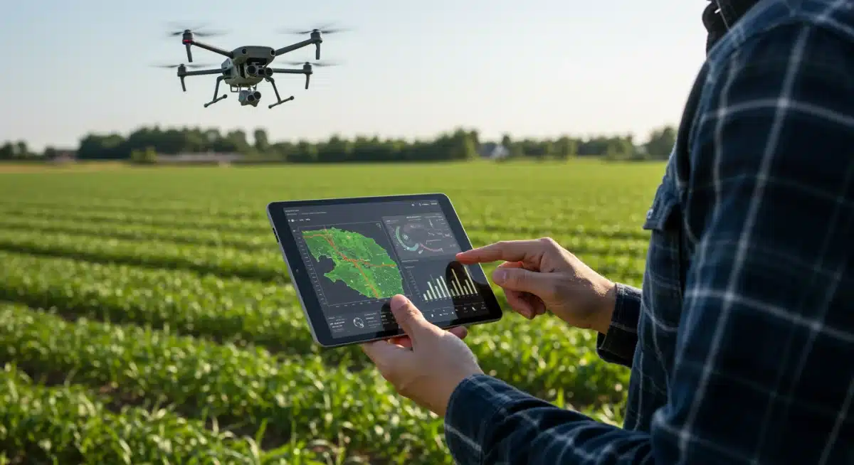
Integration with Farm Management Systems (FMS)
The true power of drone technology in crop monitoring is fully realized when its data is seamlessly integrated with comprehensive Farm Management Systems (FMS). By 2026, standalone drone operations will be a relic of the past; the future lies in a connected ecosystem where drone data flows effortlessly into a central platform, combining with other farm data sources to provide a holistic view of the operation.
This integration allows for a unified approach to decision-making, where insights from drone flights are cross-referenced with soil sensor data, weather forecasts, machinery telemetry, and historical yield records. The FMS acts as the central nervous system of the farm, processing all incoming information and presenting it in an actionable format for the farmer.
Streamlining Operations and Decision-Making
Seamless integration with FMS platforms enables automated workflows and intelligent recommendations. For instance, once a drone identifies a pest infestation, the FMS can automatically generate a spraying prescription, dispatch an autonomous sprayer, and update inventory levels, all without manual intervention. This level of automation significantly reduces labor and improves response times.
- Centralized Data Hub: All farm data, including drone imagery, sensor readings, and operational logs, is stored and analyzed in one place.
- Automated Task Generation: Insights from drone data can automatically trigger tasks within the FMS, such as variable-rate irrigation or fertilization plans.
- Performance Tracking: FMS platforms track the effectiveness of interventions based on drone monitoring, allowing farmers to refine their strategies over time.
The synergy between drone technology and FMS platforms is crucial for moving towards truly smart farming. It transforms raw data into strategic intelligence, enabling farmers to optimize every input and output. This integrated approach is a key driver behind the projected yield improvements and enhanced sustainability within the agricultural sector.
By providing a comprehensive and interconnected view of the farm, FMS integration empowers farmers to make more informed, data-driven decisions that lead to increased efficiency, reduced waste, and ultimately, higher profitability. This holistic approach ensures that drone data is not just collected but actively leveraged to improve farm performance.
Overcoming Challenges and Future Outlook
While the advancements in drone technology for crop monitoring are impressive, several challenges remain. Regulatory hurdles, data security concerns, and the need for skilled operators are all factors that need to be addressed for widespread adoption. However, the industry is actively working to overcome these obstacles, paving the way for an even more impactful future.
The regulatory landscape for drone operations is continuously evolving, with efforts to standardize rules and ensure safe airspace integration. Data security and privacy are paramount, leading to the development of robust encryption and secure data management protocols. Furthermore, educational programs are emerging to train farmers and agricultural professionals in drone operation and data analysis.
Sustainability and Economic Impact
Looking ahead, the future of drone crop monitoring in 2026 is bright, with continued innovation focused on sustainability and economic viability. The ability to precisely apply inputs, reduce waste, and improve resource efficiency directly contributes to more environmentally friendly farming practices. Economically, the promise of a 20% yield improvement translates into significant financial gains for farmers, making drone technology an attractive investment.
- Reduced Environmental Footprint: Precision application of water, fertilizers, and pesticides minimizes runoff and pollution.
- Enhanced Resource Efficiency: Optimized use of inputs leads to lower operational costs and greater sustainability.
- Increased Profitability: Higher yields and reduced waste directly contribute to improved farm profitability and resilience.
The ongoing research and development in areas like AI, sensor miniaturization, and battery life will further enhance drone capabilities, making them even more integral to agricultural operations. The collaborative efforts between technology developers, agricultural researchers, and policymakers are essential to unlock the full potential of these innovations.
Ultimately, drone technology is not just about flying machines; it’s about building a more resilient, efficient, and sustainable agricultural system. The journey towards a 20% yield improvement by 2026 is a testament to the transformative power of these aerial tools, promising a brighter future for farming and global food security.
| Key Innovation | Impact on Crop Monitoring & Yield |
|---|---|
| AI & Machine Learning | Enables predictive analytics for disease, nutrient, and yield forecasting, optimizing interventions. |
| Autonomous Swarm Technology | Increases coverage efficiency and data collection speed across large agricultural areas. |
| Hyper-spectral & Lidar Sensors | Provides ultra-detailed insights into plant health, soil composition, and 3D terrain mapping. |
| FMS Integration | Centralizes data for streamlined operations, automated task generation, and holistic decision-making. |
Frequently Asked Questions About Drone Crop Monitoring in 2026
The primary benefits include a projected 20% increase in crop yields, enhanced precision in resource application (water, fertilizers, pesticides), early detection of plant stress and diseases, and significant reductions in operational costs. These advancements lead to more sustainable and profitable farming practices.
AI and machine learning algorithms process vast amounts of drone-collected data to identify subtle patterns and anomalies. This enables predictive analytics for disease outbreaks, precise nutrient deficiency mapping, and optimized irrigation schedules, transforming raw data into actionable insights for farmers.
Hyper-spectral sensors provide detailed spectral fingerprints for plant health and soil composition, detecting issues invisible to the human eye. Lidar creates accurate 3D models of terrain and crop canopy, aiding in biomass assessment, drainage planning, and precise yield estimation, offering unparalleled detail.
Yes, autonomous drone systems, especially with swarm technology, are designed for large-scale operations. They significantly increase coverage efficiency, reduce labor needs, and ensure consistent data collection across vast areas, making precision agriculture more feasible and cost-effective for extensive farms.
Drone data is seamlessly integrated into Farm Management Systems (FMS) to create a centralized data hub. This allows for automated workflows, cross-referencing with other farm data, and intelligent recommendations, streamlining operations and enabling holistic, data-driven decision-making for optimal farm performance.
Conclusion
The trajectory of drone technology in crop monitoring by 2026 is clear: it is an indispensable force driving agricultural advancement. With innovations spanning AI-powered analytics, autonomous swarm capabilities, and hyper-spectral sensing, these aerial tools are not just improving efficiency but fundamentally reshaping how we approach farming. The promise of a 20% yield improvement is a testament to their transformative potential, offering farmers unprecedented precision, sustainability, and profitability. As challenges are met with ongoing technological evolution and collaborative efforts, drones will continue to be a cornerstone of modern agriculture, ensuring a more productive and resilient future for global food production.


