Satellite Imaging for US Farms: 10% Crop Loss Savings by 2026
Satellite imaging for early disease detection is rapidly becoming a cornerstone of modern US agriculture, offering unprecedented capabilities to monitor crop health and mitigate losses, promising up to 10% crop loss savings by 2026 for proactive farms.
Imagine a future where crop diseases are identified before they even become visible to the naked eye, saving vast amounts of produce. This is not science fiction; it’s the reality unfolding with satellite imaging for early disease detection, poised to save US farms up to 10% in crop loss by 2026.
The Dawn of Precision Agriculture: Satellite’s Role
The agricultural landscape is undergoing a profound transformation, driven by technological advancements that were unimaginable just a decade ago. At the forefront of this revolution is precision agriculture, a management strategy that employs information technology to ensure optimal health and productivity for crops and soil. Satellite imaging stands as a cornerstone of this approach, offering an aerial perspective that provides invaluable data on a scale impossible to achieve through traditional ground-based methods. This technology is not merely about taking pictures from space; it involves sophisticated sensors collecting spectral data that can reveal the nuanced health indicators of plants across vast expanses of farmland.
Historically, detecting crop diseases relied heavily on manual scouting, a labor-intensive and often reactive process. By the time a farmer could visually identify a disease, it might have already spread significantly, causing irreversible damage. Satellites fundamentally change this paradigm by enabling proactive monitoring. They offer a comprehensive overview of fields, allowing for the identification of subtle changes in vegetation indices, temperature, and moisture levels that are indicative of stress or early disease onset. This capability empowers farmers to intervene much earlier, often preventing widespread outbreaks and significantly reducing yield losses.
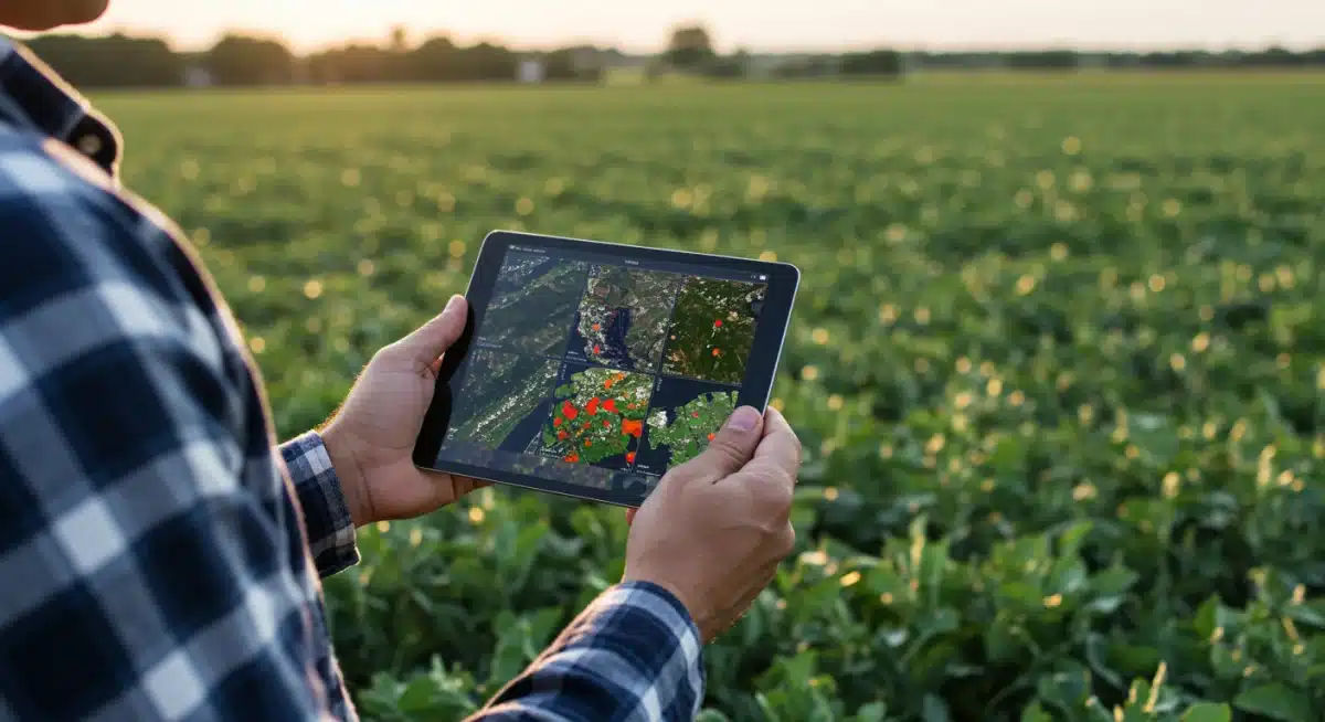
The integration of satellite data into farm management systems is streamlining decision-making processes. Farmers can now access near real-time information about their fields, allowing for targeted interventions such as precise application of fungicides or adjustment of irrigation schedules. This not only conserves resources but also boosts the overall efficiency and sustainability of agricultural operations. The promise of this technology lies in its ability to provide actionable insights, turning raw data into strategic agricultural intelligence.
Understanding Early Disease Detection Mechanisms
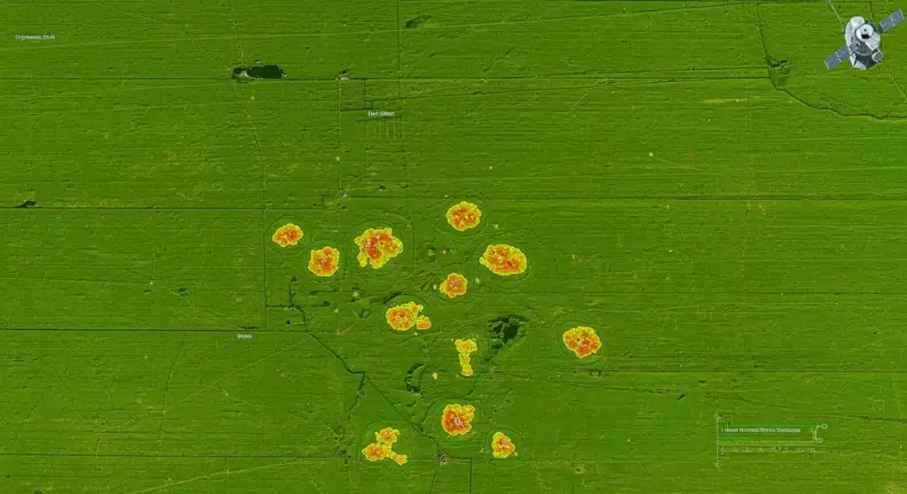
The magic behind satellite imaging for early disease detection lies in its ability to analyze spectral signatures. Healthy plants reflect and absorb light differently than stressed or diseased plants. Satellites are equipped with multispectral and hyperspectral sensors that can detect these subtle variations across various wavelengths, including visible, near-infrared, and shortwave infrared light. These sensors capture data beyond what the human eye can perceive, providing a detailed fingerprint of plant health.
Spectral Signatures and Vegetation Indices
Different plant conditions, such as nutrient deficiencies, water stress, or pathogen infections, alter the plant’s physiological processes, which in turn affects how it interacts with light. For instance, a common indicator is the Normalized Difference Vegetation Index (NDVI), which measures plant greenness and biomass. A sudden drop in NDVI in a specific area could signal a problem. However, more advanced indices and algorithms are now being developed to pinpoint the exact nature of the stress.
- NDVI (Normalized Difference Vegetation Index): Measures plant vigor and density based on red and near-infrared light reflection.
- NDRE (Normalized Difference Red Edge): Sensitive to chlorophyll content in leaves, useful for detecting stress earlier than NDVI.
- EVI (Enhanced Vegetation Index): Improves sensitivity in high biomass regions and reduces atmospheric influence.
- Thermal Imaging: Detects changes in plant temperature, often an early sign of water stress or disease response.
By comparing current spectral data with historical baselines or healthy plant signatures, algorithms can identify anomalies that suggest the onset of disease. This early warning system allows farmers to investigate specific problematic zones rather than scouting entire fields, significantly reducing the time and resources required for disease management. The development of AI and machine learning models further refines this process, enabling more accurate and rapid identification of specific pathogens based on their unique spectral patterns.
The Economic Impact: Saving US Farms Millions
The economic implications of early disease detection through satellite imaging are monumental for US agriculture. Crop diseases annually account for billions of dollars in losses globally, and the US is certainly not immune. By enabling farmers to detect and address issues before they escalate, satellite technology offers a direct pathway to significant savings. The projected 10% reduction in crop loss by 2026 represents a substantial financial boon for individual farmers and the national agricultural economy as a whole.
Quantifiable Benefits for Farmers
Reduced crop loss directly translates to higher yields and increased revenue. Beyond that, early detection minimizes the need for broad-spectrum pesticide applications, leading to savings on input costs. Targeted treatments mean less waste and a more efficient use of expensive resources. This efficiency also extends to labor, as fewer hours are spent on manual scouting and more on strategic intervention.
- Increased Yields: Preventing disease spread ensures more healthy crops reach harvest.
- Reduced Input Costs: Targeted application of pesticides and fertilizers.
- Optimized Labor: Less time spent on manual inspection, more on effective management.
- Improved Crop Quality: Healthier plants produce higher quality produce, commanding better market prices.
Furthermore, the ability to predict potential outbreaks allows farmers to make informed decisions about crop rotation, variety selection, and planting schedules, improving long-term farm profitability and resilience. The cumulative effect of these benefits positions satellite imaging as a critical investment for the future financial stability of US farms. The data-driven insights empower farmers to operate with greater confidence and less uncertainty, transforming farming from a reactive endeavor into a highly proactive and optimized process.
Technological Advancements Driving the 2026 Forecast
The optimistic forecast for 2026 regarding crop loss savings is not merely speculative; it is grounded in a rapid pace of technological innovation. Several key advancements are converging to make satellite-based disease detection more accurate, accessible, and actionable than ever before. These improvements span from the satellites themselves to the algorithms that interpret their data.
Key Innovations in Satellite Technology
New generations of satellites are being launched with enhanced sensor capabilities. These include higher spatial resolution, allowing for the detection of smaller problem areas, and increased temporal resolution, meaning more frequent revisits over the same field. This provides a richer, more dynamic dataset for analysis. Hyperspectral imaging, which captures data across hundreds of narrow spectral bands, is becoming more prevalent, offering an unprecedented level of detail in identifying specific plant stresses and diseases.
- Higher Resolution Sensors: Capturing finer details on plant health at the individual plant level.
- Increased Temporal Resolution: More frequent data updates, enabling near real-time monitoring.
- Hyperspectral Imaging: Differentiating between various types of stress with greater precision.
- AI and Machine Learning Algorithms: Automating data analysis and improving disease identification accuracy.
Beyond the hardware, the development of sophisticated artificial intelligence (AI) and machine learning (ML) algorithms is revolutionizing data interpretation. These algorithms can process vast amounts of satellite data, identify complex patterns indicative of specific diseases, and even predict their spread based on environmental factors. The integration of satellite data with other sources, such as weather patterns, soil conditions, and historical yield data, creates a holistic picture that empowers farmers with comprehensive predictive analytics. This continuous cycle of data collection, analysis, and feedback is what truly underpins the ambitious goals for crop loss reduction by 2026.
Challenges and the Path to Wider Adoption
While the benefits of satellite imaging for early disease detection are clear, widespread adoption across all US farms faces several challenges. These hurdles range from technological accessibility and cost to the need for education and infrastructure development. Addressing these issues is crucial for realizing the full potential of this groundbreaking technology.
One significant challenge is the initial investment cost associated with advanced precision agriculture tools and services. Smaller farms, in particular, might find the upfront costs prohibitive, even if the long-term returns are substantial. Furthermore, the complexity of interpreting satellite data and integrating it into existing farm management practices requires a certain level of technical expertise. Many farmers may need additional training or access to specialized consultants to effectively leverage these tools.
Overcoming Adoption Barriers
- Cost-Effectiveness: Developing more affordable solutions and subscription models for smaller farms.
- User-Friendly Interfaces: Simplifying data visualization and actionable insights for farmers.
- Education and Training: Providing resources to help farmers understand and implement satellite data.
- Internet Infrastructure: Ensuring reliable high-speed internet access in rural agricultural areas.
Another critical aspect is the availability of robust internet infrastructure in many rural farming communities. High-speed internet is essential for transmitting and processing the large volumes of data generated by satellite imagery. Government initiatives and private sector investments are vital to bridge this digital divide. As these challenges are systematically addressed through innovation, policy support, and educational outreach, the adoption curve for satellite imaging technology in US agriculture is expected to accelerate significantly, pushing closer to the projected savings goals.
The Future Landscape: Beyond 2026
Looking beyond 2026, the trajectory for satellite imaging in agriculture is one of continuous evolution and increasing sophistication. The advancements we see today are merely the foundation for what is to come. The future promises even greater integration of diverse data sources, more precise predictive models, and ultimately, a more resilient and sustainable agricultural system.
One key area of future development is the convergence of satellite data with ground-based sensors, drones, and even robotic scouts. This multi-layered data approach will provide an unparalleled level of detail and real-time monitoring, creating a truly intelligent farm ecosystem. Imagine individual plants being monitored for stress and disease, with interventions automatically triggered based on precise data analysis. This level of autonomy and precision will further optimize resource use and minimize environmental impact.
Emerging Trends and Technologies
- Data Integration Platforms: Seamlessly combining satellite, drone, and ground sensor data.
- Hyper-Localized Weather Prediction: Integrating satellite data for more accurate microclimate forecasts.
- AI-Driven Prescriptive Analytics: Offering specific, automated recommendations for disease management.
- Blockchain for Traceability: Using satellite data to verify sustainable practices and food origin.
Furthermore, the role of AI will expand to not only detect but also predict the emergence and spread of novel pathogens, adapting to changing environmental conditions and agricultural practices. This proactive intelligence will be critical in mitigating risks from climate change and evolving disease patterns. The vision for agriculture beyond 2026 is one where technology acts as an intuitive partner, guiding farmers towards maximum productivity and environmental stewardship, ensuring food security for a growing global population.
| Key Point | Brief Description |
|---|---|
| Early Detection | Satellites identify crop diseases before visual symptoms appear, enabling proactive intervention. |
| Economic Savings | Projected 10% reduction in crop loss by 2026, saving US farms millions annually. |
| Advanced Technology | Hyperspectral sensors, AI, and ML algorithms enhance detection accuracy and speed. |
| Future Outlook | Integration with other data sources and predictive analytics for sustainable agriculture. |
Frequently Asked Questions About Satellite Imaging in Agriculture
Satellites use multispectral and hyperspectral sensors to detect subtle changes in how plants reflect light. Healthy and diseased plants have different spectral signatures, allowing specialized algorithms to identify stress indicators long before they become visible to the human eye.
Early detection can prevent losses from a wide range of diseases, including fungal infections, bacterial blights, and viral diseases. By enabling timely intervention, farmers can contain outbreaks, minimize spread, and save significant portions of their crops that would otherwise be lost.
While initial costs can be a consideration, more affordable solutions and subscription-based services are emerging. The long-term savings from reduced crop loss and optimized resource use often outweigh the investment, making it increasingly viable for small to medium-sized operations.
Accuracy is continuously improving with advancements in sensor technology and AI/ML algorithms. While not 100% foolproof, satellite data provides highly reliable early warnings, guiding farmers to specific areas for ground-truthing and precise intervention, significantly enhancing overall farm management.
Beyond disease, satellite imaging helps monitor water stress, nutrient deficiencies, pest infestations, and overall crop vigor. It aids in optimizing irrigation, fertilizer application, and yield forecasting, contributing to more efficient and sustainable farming practices.
Conclusion
The integration of satellite imaging for early disease detection is rapidly reshaping the future of US agriculture. By providing an unprecedented level of insight into crop health, this technology empowers farmers to move from reactive crisis management to proactive, data-driven decision-making. The projected saving of up to 10% in crop loss by 2026 underscores not just the economic benefits, but also the profound impact on food security and sustainable farming practices. As technology continues to evolve and become more accessible, satellite imaging will undoubtedly remain a cornerstone of modern, resilient agricultural systems, ensuring healthier crops and more prosperous farms for years to come.


