Satellite imagery for yield prediction: unlock your farm’s potential
Satellite imagery for yield prediction enables farmers to accurately assess crop health and optimize management practices, resulting in increased yields and reduced costs through data-driven decision-making.
Satellite imagery for yield prediction is transforming agriculture by providing farmers with unique insights into crop health and yield potential. Have you ever wondered how aerial data can affect your farming decisions? Let’s dive in!
Understanding satellite imagery technology
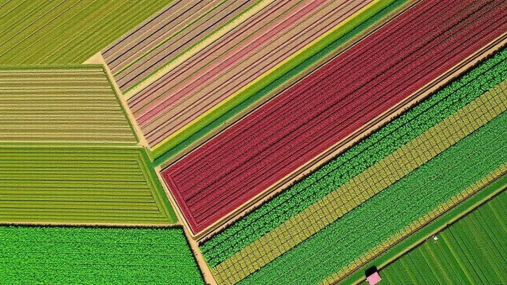
Understanding satellite imagery technology is key to unlocking its potential in agriculture. This technology captures high-resolution images of the Earth’s surface, making it easier for farmers to monitor their fields. By using data collected from various satellites, farmers can gain insights into crop health, soil conditions, and weather patterns.
The images produced allow for comprehensive analysis of agricultural landscapes, revealing information that is often invisible to the naked eye. Advances in technology have improved the clarity and detail of the images, providing farmers with valuable data that helps in decision-making.
Key Features of Satellite Imagery
There are several features that make satellite imagery valuable:
- High resolution: Captures detailed images of large areas.
- Real-time data: Provides up-to-date information that can influence immediate decisions.
- Multi-spectral imaging: Allows for analysis beyond visible light, such as infrared.
- Historical data: Enables comparison across growing seasons, helping track changes over time.
With these features, farmers can assess crop health more accurately. For instance, using multi-spectral imaging, farmers can detect issues like nutrient deficiencies or pest infestations before they become severe.
Benefits of Using Satellite Imagery in Agriculture
The impact of utilizing this technology is significant:
- Improved yield predictions based on data-driven analysis.
- Enhanced resource management, optimizing water and fertilizer use.
- Increased ability to respond to factors such as drought or disease.
By integrating satellite imagery into their practices, farmers can take a proactive approach to crop management. This not only improves productivity but also contributes to sustainable farming practices, ensuring efficiency in resource usage.
As technology continues to advance, the applications of satellite imagery are likely to grow, enhancing precision agriculture further and supporting farmers in achieving their goals.
The role of yield prediction in agriculture

The role of yield prediction in agriculture is crucial for farmers aiming to maximize their productivity. Accurate predictions help in planning and managing resources effectively. By understanding potential yields, farmers can make informed decisions about planting, fertilizing, and harvesting crops.
Yield prediction uses data from various sources, including satellite imagery, weather forecasts, and historical crop performance. This data helps in creating models that estimate future yields with greater accuracy. As a result, adjusting farming practices becomes easier, allowing for more efficient use of inputs.
Benefits of Accurate Yield Prediction
Implementing yield prediction offers several advantages:
- Enhanced resource allocation: Farmers can optimize water and fertilizer use based on predicted needs.
- Risk management: Identifying potential low yields can help farmers take preventive measures.
- Improved financial planning: Farmers can secure funding and plan for market conditions better.
With precise predictions, farmers can strategically plan for unexpected challenges, like droughts or pest outbreaks. This adaptability increases resilience and helps in maintaining crop health throughout the growing season.
Tools and Technologies for Yield Prediction
Several tools are utilized in yield prediction:
- Data analytics software: These programs analyze vast amounts of data for accurate forecasting.
- Machine learning models: Algorithms improve predictions over time by learning from new data.
- Remote sensing: Techniques that gather data from a distance allow farmers to monitor crops in real-time.
By embracing these innovations, farmers can enhance their understanding of their fields. Good yield predictions empower them to make better decisions that lead to increased harvests and sustainable practices.
How satellite imagery improves crop management
How satellite imagery improves crop management is a game changer for farmers. This technology provides crucial insights into the health and condition of crops, allowing for better decision-making. By analyzing satellite data, farmers can monitor crop growth, detect issues early, and respond appropriately.
One way satellite imagery helps is through regular monitoring. Farmers can track their fields over time, understanding how different areas respond to weather changes. This allows them to adjust practices, ensuring that each part of their field receives the care it needs. By identifying problems like pest infestations or nutrient deficiencies early on, they can implement solutions quickly.
Benefits of Satellite Imagery in Crop Management
Utilizing satellite imagery in agriculture offers numerous benefits:
- Enhanced visibility: Farmers can see their entire fields clearly from above.
- Precision farming: Allows for targeted application of fertilizers and pesticides.
- Efficient irrigation management: Helps in assessing water needs across different areas.
- Yield optimization: Provides data to help increase overall crop yields.
By making informed choices based on satellite imagery, farmers can optimize their resources. For example, they can determine where additional water is needed or where soil amendments should be applied. This targeted approach not only conserves resources but also maximizes productivity.
Integrating Satellite Imagery with Other Technologies
The synergy of satellite imagery with other modern technologies enhances its effectiveness. Combining satellite data with ground sensors allows for more detailed insights. Ground sensors collect real-time data about soil moisture and temperature, which can be overlaid with satellite images for a complete picture.
Furthermore, integrating satellite imagery with machine learning algorithms enables predictive analytics. These systems analyze historical data and trends, helping farmers anticipate future conditions. Ultimately, this leads to more proactive and successful crop management, fostering sustainability in agriculture.
Real-world success stories of yield prediction

Real-world success stories of yield prediction highlight how farmers are leveraging data to enhance their agricultural practices. By implementing advanced techniques, these farmers see significant improvements in productivity and efficiency. Let’s explore some inspiring examples.
In one case, a vineyard in California used satellite imagery to monitor grape health throughout the season. By analyzing the data, the vineyard manager could adjust irrigation and nutrient applications based on specific needs. As a result, they increased their grape yield by over 20%, while also reducing water usage.
Case Study: Corn Farmers in Iowa
In Iowa, a group of corn farmers integrated yield prediction technology into their operations. They utilized a combination of historical data, soil analysis, and satellite imagery to forecast yields accurately. This approach allowed them to:
- Tailor their planting strategies for different field zones.
- Optimize fertilizer application, reducing costs by 15%.
- Increase crop yields by up to 30% compared to conventional methods.
This data-driven method empowered farmers to make informed decisions, improving their bottom line and contributing to sustainable practices.
Success in Soybean Production
Another impressive success story comes from soybean farmers in Brazil, who adopted yield prediction technologies to enhance their planting strategies. By employing remote sensing tools, they could check crop conditions regularly. This led to:
- Early detection of pests and diseases, allowing for timely interventions.
- Better resource management, ensuring optimal use of water and fertilizers.
- A forecasted yield increase of 25%, significantly boosting profits.
Their experience showcases how embracing innovative technologies can revolutionize traditional farming practices, leading to impressive results and higher sustainability standards.
FAQ – Frequently Asked Questions about Yield Prediction in Agriculture
What is yield prediction and why is it important?
Yield prediction uses data and technology to estimate how much crop will be produced. It is important because it helps farmers plan better and improve their production.
How does satellite imagery help with yield prediction?
Satellite imagery provides detailed information about crop health and conditions, allowing farmers to make informed decisions based on real-time data.
Can yield prediction reduce costs for farmers?
Yes, by using yield prediction, farmers can optimize their resource use, such as water and fertilizers, which can lead to significant cost savings.
What are some real-world examples of successful yield prediction?
Success stories include vineyards utilizing satellite data to increase grape yields by over 20%, and Iowa corn farmers improving yields by up to 30% through data-driven methods.


